13 August 2024
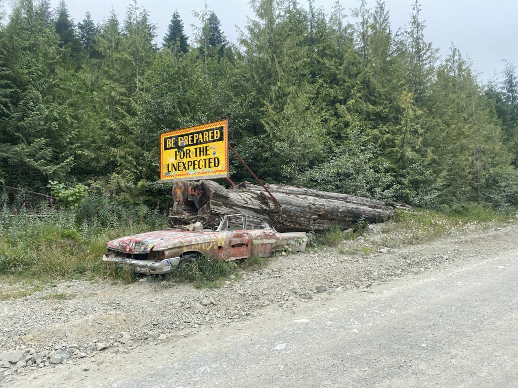
Leaving Alaska behind us, we reentered Canada and started to head south. I’ll recommend the Yukon bikers’ campground to any bikers out there – it’s where I changed the oil in my Ducati on the way north. A couple of long days in the saddle saw us joining the glorious Cassier – Stewart Highway which runs down to the east of the mountains, for once we could enjoy a road that bends, twists and undulates through more forests and lakes. I came down this road on my longer trip (see loosenuts.blog) in 2017; I remember the huge expanses of trees, trees and more trees that were visible where the road rises to afford a longer view. This time, however, for approximately 30 miles or more a recent fire had destroyed everything, leaving just charred stumps and the tree skeletons laid horizontally. It looked like the aftermath of a nuclear bomb, I was reminded of the devastation I witnessed at Mount St Helens ten years after that volcano erupted and blew its top off in 1980. However, sad as it was to see the trees laid to waste, one has to keep it in perspective. We have spent day after day riding through forest, views have been of trees as far as the eye can see seemingly for weeks on end. I might have ridden past evidence of recent wildfires for two or three hours in the past 8 weeks of riding, so as a proportion the burned area remains small. Having said that, the fires are more frequent and bigger each year, as a consequence of increasing temperatures and a shortage of rain, so there is no place for complacency. As a footnote, the number of trees is mind-boggling. I have no idea how many I have seen, is it measured in millions, billions or trillions?

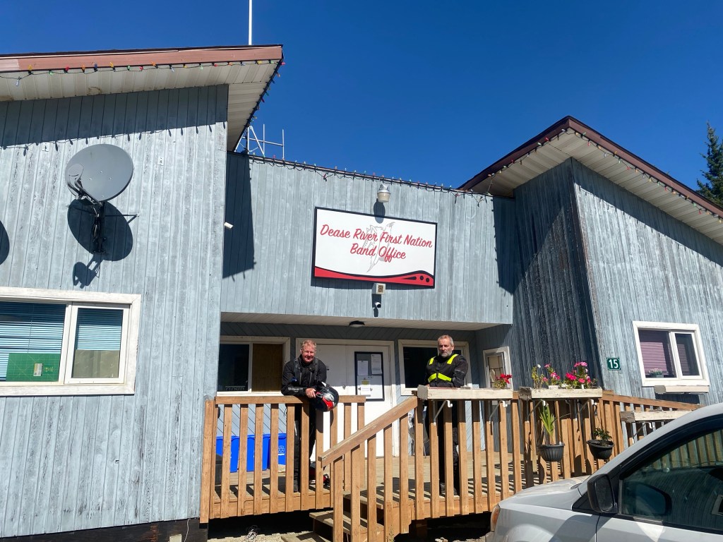
We were aiming for Dease Lake, where a pleasant motel stands at the top of Telegraph Creek Road. Having left Watson Lake after breakfast, there was no option for a coffee stop for at least 120 km. A gas station at Good Hope suggested a possibility, but nothing doing. The guy working there suggested I try the building next door, which turned out to be the community administrative centre for the village. This was a First Nation community, and the very charming young lady, whose name is Layla (and who is well versed with Derek and the Dominos), confirmed that there was no cafe anywhere near, but she offered to make coffee for us. Once again, we were struck by the kindness and generosity of people. It was a good opportunity to chat and learn a bit more. She told me that the village has 38 residents, and when I enquired how much work was involved in administering such a small group, she assured me that she and her colleague were very busy applying for funds to build new housing, and also a new community centre.
The First Nation population are semi-autonomous and not much troubled by the edicts of central government (forgive me if that is not quite true, but it is what I have been told in several First Nation areas) although they do rely on the government for much of the funding that allows them to continue their way of life. Maybe this equation is an expression of some national feeling of guilt? I don’t know. If any of my Canadian friends have a view, I’d love to hear from you. The coffee was most welcome – thanks Layla.
Having reached Dease Lake by lunchtime, we each took the luggage off our bikes and started down the road to Telegraph Creek. I had developed a yearning for the remote roads, especially those without asphalt. I’m starting to get the hang of dirt and gravel roads, although I do feel for the poor bike as it is banged about over the rougher terrain.
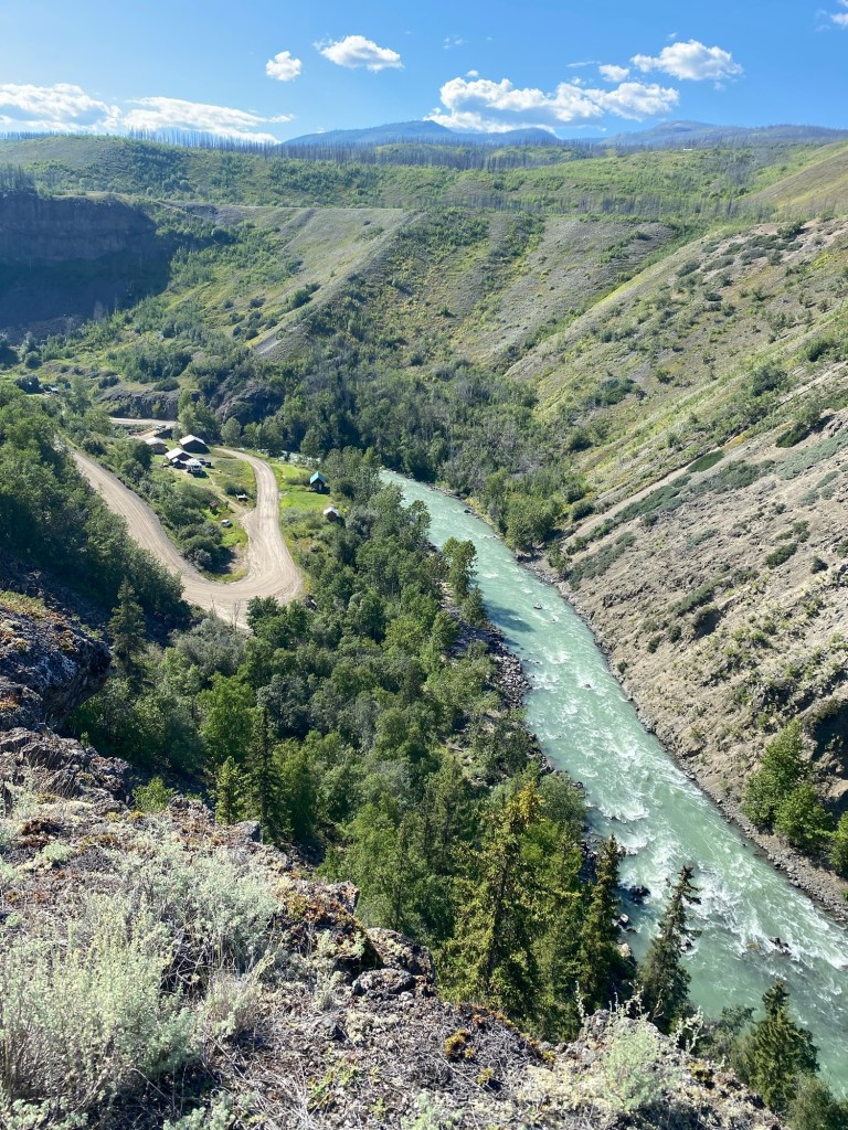
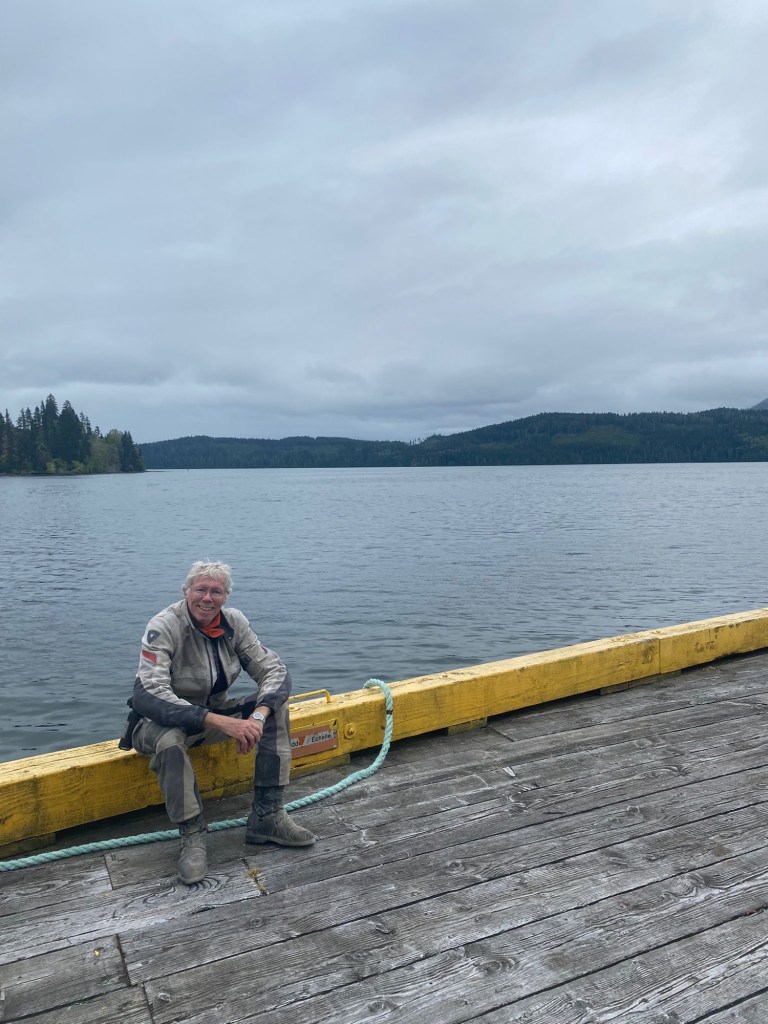
Telegraph Creek is another tiny community, 110 km down a gravel road, that also has a history shaped by gold. It has been populated by the Tahltan people for millennia, who fish along the banks of the Stikine River. In 1860 gold was discovered there, and the Hudson’s Bay Company established a trading post 18 km downriver which moved to Telegraph Creek in 1900. Also in the 1860s, the Western Union Telegraph Company attempted to link America with Europe through BC, Alaska and Siberia; the route they chose followed the Stikine River and this location became known as Telegraph Creek. The project was never finished though as a transatlantic cable made the plan obsolete. In the Klondike gold rush of 1898, the creek came alive with thousands of gold seekers making their way to the gold mining areas of the Yukon; two main routes to the north converged here. Now, all that is gone and life seems to have returned to its previous placid pace, with some old buildings fallen into disrepair as the only evidence of its spasm of activity. It took over two hours to ride there, with hairpin bends and some steep inclines and descents, stopping to gawp at the magnificent scenery and take photos, but somewhat less to ride back at a slightly more frenetic pace. Massive fun!

This whole part of our route retraces the steps I had taken previously, but it was a sheer joy to revisit.
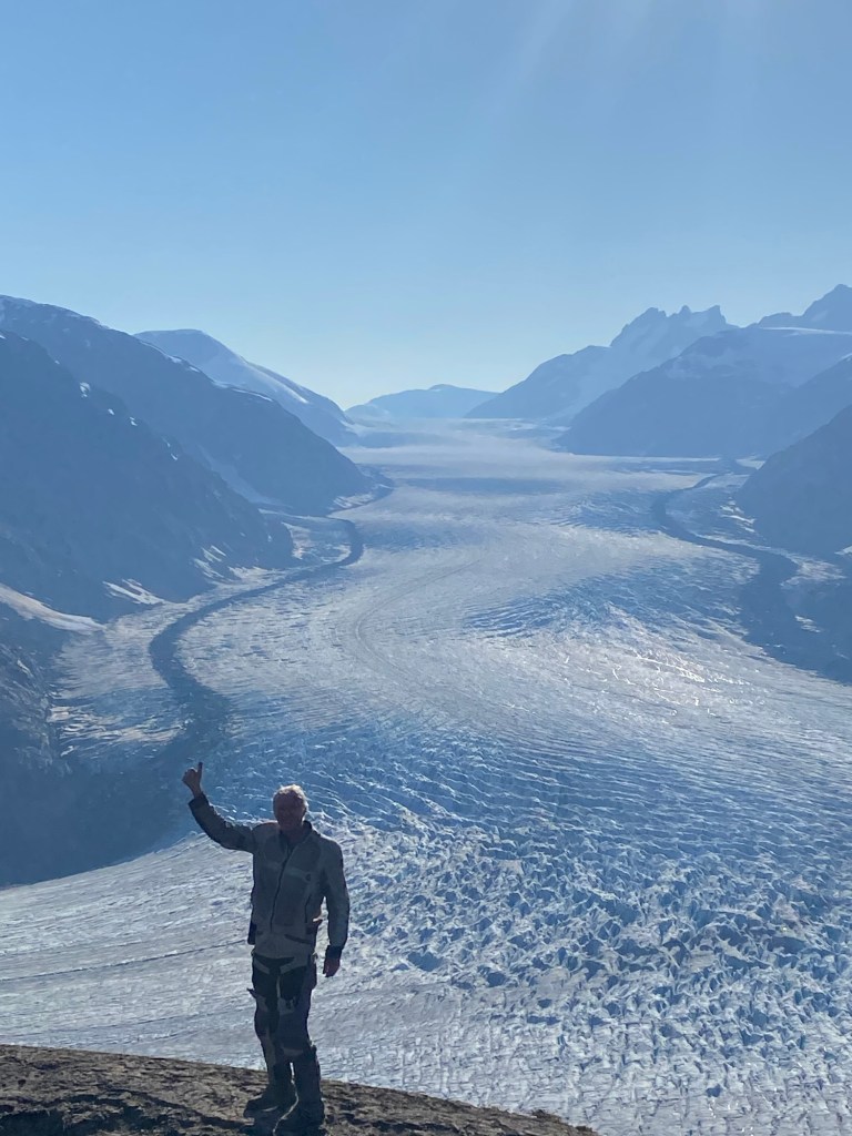
Once we arrived in Stewart, another rocky gravel road took us up to the simply awesome Salmon Glacier, so named because it feeds the salmon rivers below, where grizzly bears get an easy meal. The water is shallow and literally thick with fish. Bears feed here so regularly at this time of year that a viewing platform has been built, which does give it a slightly artificial feel, but it is really not. We watched for almost an hour, not one but two grizzlies came for supper.
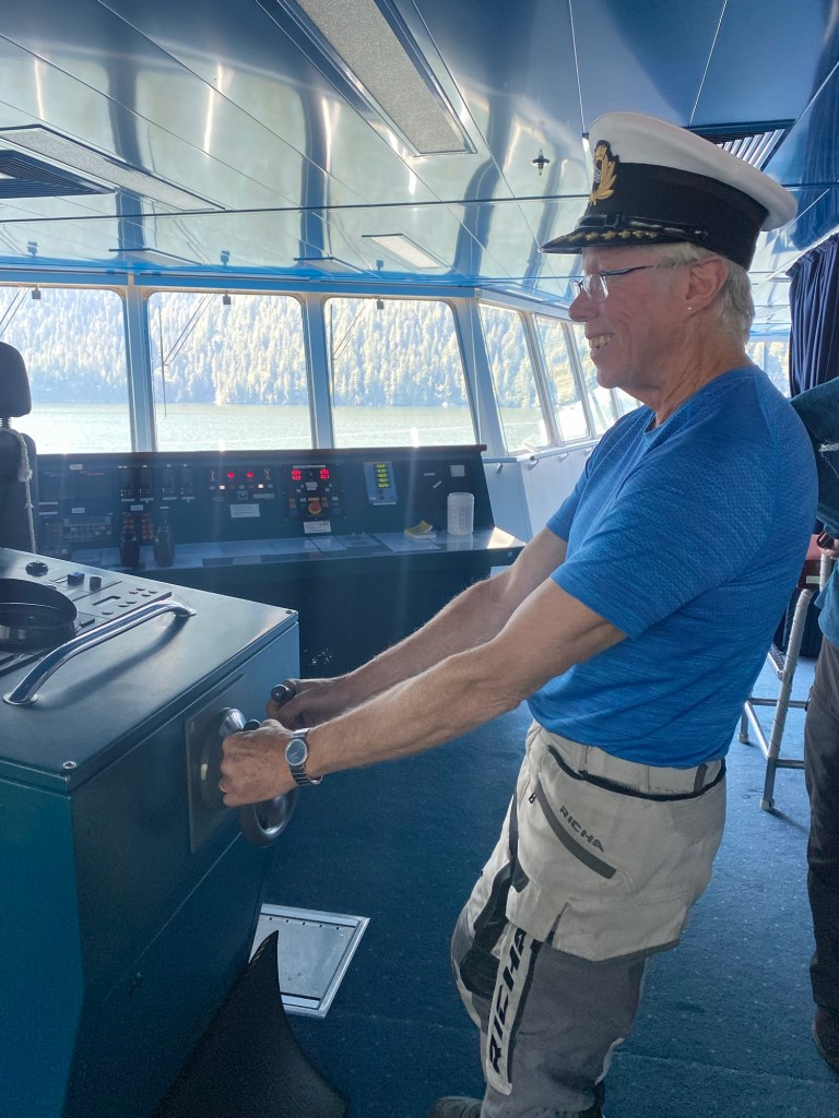
Rather than another two or three days riding down to Vancouver, we had elected to take a ferry from Prince Rupert to Port Hardy at the northern edge of Vancouver Island which gave us a welcome rest day, and also some unexpected interest – aside from spotting a few humpback whales, Dave somehow managed to get us an invitation to have a tour of the engine room, and also to visit the bridge.
Dave’s brother Steve lives on Vancouver Island and he joined us the next day for a tour of the north of the island – there are almost no actual roads up there, so this was on logging trails, more rocky gravel roads to shake the bike to bits. It was great to see Steve again and meet his family.
Each of the three of us had slightly different agendas at this point. Dave wanted to see more of his brother and in-laws, Chris wanted to spend some time with his son who lives in Whistler and came to spend some time with his dad, and I wanted to get up to Whistler where my great friend Sue has a condo and I had an invitation to stay. It is from there that I am writing, in the lap of luxury after so long on the road. Having been here a few times in the past, but only in winter, it was special to ride along Horseshoe Bay and then up the Sea to Sky highway. And that was after an enchanting ferry crossing from Nanaimo, a real unexpected pleasure watching for the whales that would spout on the left and right, but which I managed to miss entirely, and excellent conversations and company from lovely co-travellers. It’s what it is all about, when it comes down to it.

Leave a comment